Morgan County Archery Association
Map & Directions
Morgan County Archery Association
Map & Directions
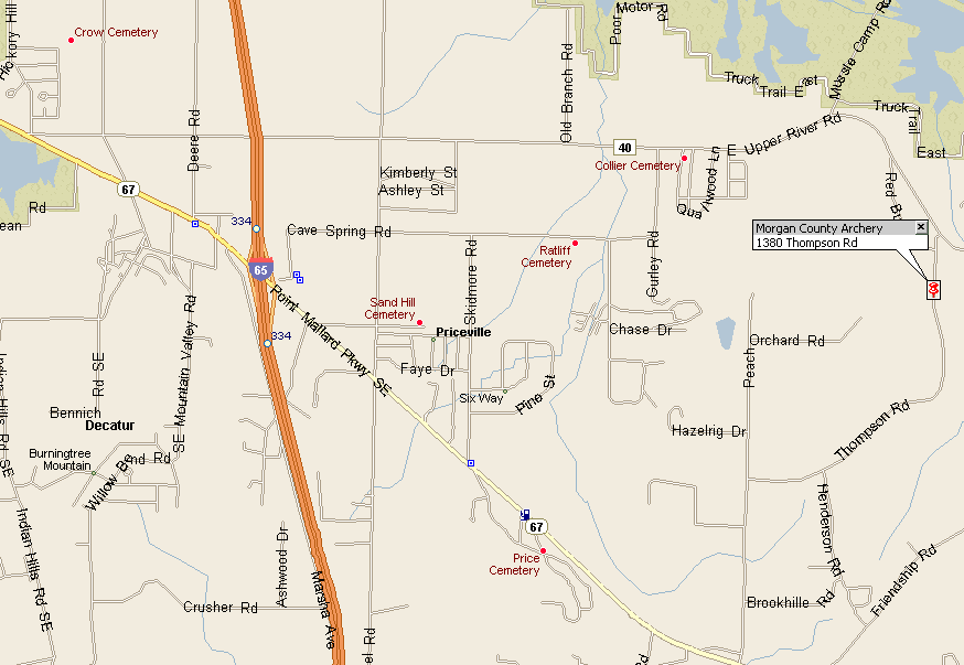
Directions to Morgan County Archery Association Range
From Decatur:
If coming from Decatur on Hwy
67 going toward Priceville, turn left onto Upper River Road (at flashing
caution light in front of REMAX). Go approx. 5 miles, turn right onto
Thompson Road NE. Go approx. 350 yards and range entrance is on the
right through yellow metal gate.
From I-65 headed South:
Take the Decatur/Priceville exit to the right, at Highway 67, turn right and go West towards Decatur, go 1 block past Pilot gas station, turn right onto Deere Rd, at the stop sign, turn right onto Upper River Rd. Follow Upper River Rd approximately 3.5 miles, turn right onto Thompson Rd NE. Go approx. 350 yards and range entrance is on the right through yellow metal gate.
From Huntsville headed South:
If coming from South Parkway
in Huntsville, go out Highway 231 South to Lacey Springs. Turn right
onto Hwy 36 toward Cotaco, go approx. 9 miles. Turn right onto Upper
River Road (across from Valhermoso Post Office) and go approx. 10 miles,
turn left onto Thompson Road NE. Go approx. 350 yards and range entrance
is on the right thru yellow metal gate.
Physical location for Mapquest is 1380 Thompson Road NE, Decatur, AL
35603.
If you need further assistance, contact Clete Blankenship at
bclete@charter.net or 256-353-5490 (office) or 256-318-9006 (cell).
Entire contents © 2010, High Tech Archery Range. All Rights Reserved.